Palm Springs International Airport (PSP)
Driving Directions / Travel by Car
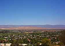
(Palm Springs, California - CA, USA)
Serving the Californian city of Palm Springs, as well as smaller regional towns in the area, Palm Springs International Airport (PSP) is an important regional hub. The airport complex lies near to the I-10 interstate and US-111 freeway (East Palm Canyon Drive), and is located just 2 miles / 3 km to the east of Palm Springs city center.
Roads surrounding Palm Springs Airport include the North Gene Autry Trail to the east, the East Ramon Road and El Cielo Road to the south, and the East Vista Chino to the north, off Sunrise Way.
Directions to Palm Springs International Airport (PSP):
- Take the US-111 highway southeast through Palm Springs and follow it until it becomes Gene Autry Trail and intersects with Ramon Road
- Turn right onto Ramon Road and travel west to Airport Entrance Road. Follow the signs to the terminal building
Directions to Palm Springs International Airport (PSP) from the northwest:
- Take the I-10 interstate southwest to the Gene Autry Trail exit (also signposted Palm Drive / Desert Hot Springs) and turn right onto Gene Autry Trail. Travel south to Ramon Road
- Turn right onto Ramon Road and travel west to Airport Entrance Road. Follow the signs to the terminal building
Directions to Palm Springs International Airport (PSP) from the southeast:
- Take the I-10 interstate northeast to the Ramon Road exit
- Turn left onto Ramon Road and travel west to Airport Entrance road. Follow the signs to the terminal building
Palm Springs is not a very busy city, so there are rarely traffic jams during normal hours of the day, particularly along the main routes and I-10 interstate. However, you should always allow ample time for your journey.
Palm Springs International Airport (PSP): Virtual Google Maps
